1 / 3

3 Fotos
$1,138,000
Anuncio Original
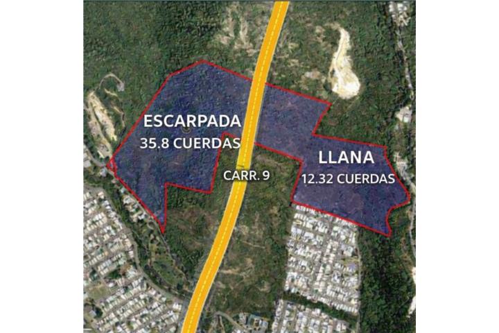
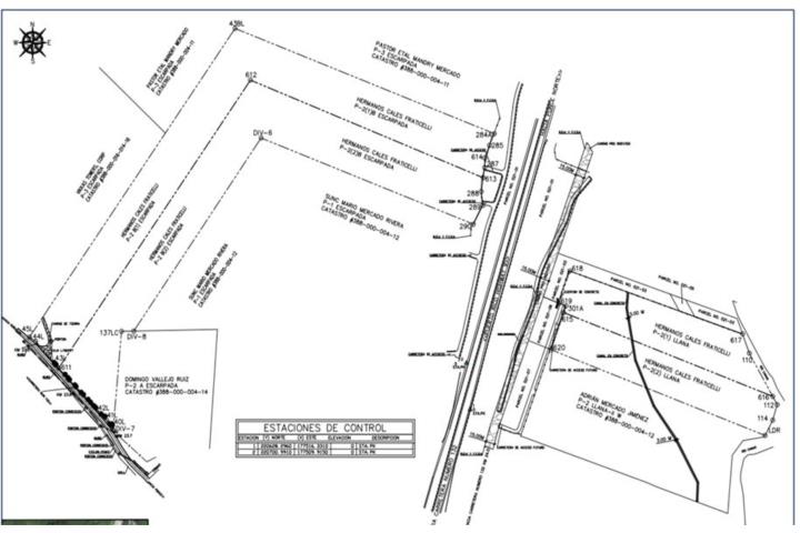
TASACION RECIENTE- FOR SALE – 48.14 Cuerdas of Land in Canas Ward, Ponce, Puerto Rico Location: East of PR-132 KM 23.6, Canas Ward, Ponce, PR 00728 Coordinates: Latitude 18°02'139"N / Longitude -66°64’692”W (Approx.) A rare opportunity to acquire 48.1403 cuerdas of vacant land with mixed topography and broad development potential. The site combines 35.80 cuerdas zoned SUP / SREP.N (steep, conservation areas) and 12.33 cuerdas zoned AP.4 (level, developable areas). The property sits directly off PR-132 with convenient access to PR-9, PR-123, PR-500 and PR-501. Total Land Area: 48.1403 cuerdas 35.8085 cuerdas (escarpadas) – Zonificación SUP y SREP.N (conservación) 12.3318 cuerdas (llanas) – Zonificación AP.4 (áreas aptas para desarrollo) Topography: Combination of level terrain and steep hills; irregular shape Accessibility: Frontage and direct access from PR-132 (state road, two lanes, asphalt) Exposure: Medium traffic – primary connector from Ponce to Peñuelas Utilities: Electric power lines Access to potable water (not connected) ephone and sanitary sewer lines near the site Zoning R-B & R-I: Allows low and intermediate density residential development Flood Zone X Boundaries North: PR-501 (Las Delicias Development) South: PR-132 (Jardines del Caribe Development) East: PR-9 and PR-123 (El Madrigal Development) West: PR-132 and PR-500 (Pastillo River) For information and appointments: Ginette Pérez Campo Lic. C-17675 giniperezcampo@gmail.com
Caracteristicas
48.1403 Cuerdas Totales De Terreno Vacante
Ubicación: Barrio Canas, Ponce, Pr, Este De Pr-132 Km 23.6
Acceso Directo Desde Pr-132 (Carretera Estatal Asfaltada)
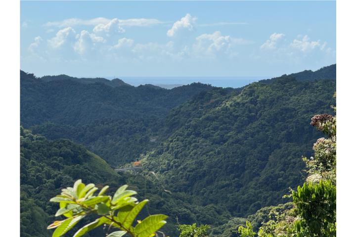
Topografía Mixta: Terreno Llano Y Colinas Pronunciadas
Zona De Inundación X
Coordenadas Aproximadas: 18°02'139"n / -66°64'692"w


$1,138,000
WhatsApp